John Ruhs, former BLM NV State Director and current ID State Director, announced at the PLC Annual Meeting that the Jordan Meadows Collaborative Group is the recipient of the 2020 Sagebrush Steppe Stewardship Award. A separate meeting will be scheduled for Loyd Sherburn, from the Home Ranch, to accept the award on behalf of the group.
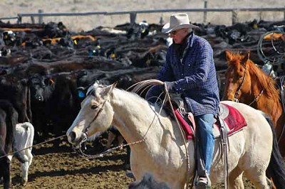 John Falen and his family have been running a cow-calf operation on the Home Ranch in Orovada, Nevada since 1977. Son-in-law, Loyd Sherburn, joined them in 1979 and has been the ranch manager for the past 5 years. Combined, the Home Ranch and associated BLM grazing allotments encompass approximately 320,000 acres (98% BLM and 2% private). The Jordan Meadows allotment contains three streams occupied by threatened Lahontan cutthroat trout (LCT). It also provides important habitat for mule deer and antelope and is considered the most important greater sage-grouse habitat in a three-state area. For many years, management of the Jordan Meadows allotment was contentious with relationships and interactions between BLM, NDOW, USFWS and the permittees characterized by lack of trust, conflict, and litigation.
Like many allotments across the west, the management plan for the Jordan Meadows allotment is old and out-of-date. It was part of a large landscape managed under direction dating back to a 1982 Record of Decision. Following consultation for LCT, changes were made to improve LCT habitat and a Biological Opinion and Final Multiple Use Decision were issued in 1995. These documents provided management direction (mainly fencing of riparian areas and more stringent standards for utilization in riparian areas) and remain in effect today.
In 2015, several challenges were being confronted regarding the Jordan Meadows allotment; the area was entering the fourth year of drought, numbers of LCT were down to single digits, fencing needs were not being addressed, monitoring was incomplete or insufficient, communication was poor among all parties, and a trespass notice was issued to the permittee. In preparation for the development of a new grazing term permit renewal, renewed emphasis was placed on creating a sustainable forum for facilitated dialogue, collaborative problem-solving, and conflict resolution among the diverse parties. The BLM Field Office contacted the National Riparian Service Team (NRST) for assistance and in October 2016 the Jordan Meadows Collaborative was formed. The intent was to improve relationships, create a common understanding of the current situation, develop a shared vision of what is needed to maintain and improve riparian and upland conditions, and experiment with various grazing strategies (within the confines of the current permit) to inform the development of alternatives for the upcoming term permit renewal.
“In the beginning, working with the National Riparian Service Team, there was… skepticism and lack of trust on both sides. Since working with the team, we have built trust and working relationships for the betterment of both public lands and the viability of the ranch. Being a family operation, it is important to sustain this ranch for future generations. By working together, we have accomplished a lot with much more to accomplish in the future. I am hoping this model can help other ranchers and government agencies and be beneficial to all.” – Loyd Sherburn, Home Ranch
The Jordan Meadows Collaborative group has about 15 active participants – the permittee and ranch manager plus various representatives from the BLM Field Office and the NRST, USFWS, NDOW, UNR Cooperative Extension, the Conservation District, and Trout Unlimited. The initial action plan was finalized shortly after the first meeting and focused on the development of effective riparian management strategies. Riparian resources constitute a very small portion of the allotment and water is short in large portions of the allotment resulting in continual difficulties with livestock distribution and little to no ability to utilize portions of the forage resource. As a result, initial actions were largely designed to determine the status of existing and potential future water gaps, springs, troughs and wells; complete lotic and lentic PFC assessments and monitoring; and identify structural improvements needed for better control and distribution of livestock.
Each spring, the collaborative identifies opportunities to adjust timing, intensity, and duration of grazing within the parameters of the existing final multiple use decision to minimize and manage concentrated livestock use on riparian areas during the growing season and improve riparian conditions. The group meets for a summer a field tour focused on issues being considered or results of actions. In the fall, the group reviews how the year progressed sharing lessons learned, monitoring data, and observations. All decisions are made by the responsible line officer following group discussion and adherence to required NEPA processes.
Over the years, the collaborative has worked to improve riparian condition on the three LCT occupied streams. In 2017, the permittee voluntarily agreed to remove livestock from the upper elevation summer pastures with LCT occupied streams approximately 15 days early during the growing season. This provides reduced concentrated use most years, while also retaining the flexibility to occasionally use the pastures a few additional days as appropriate. In 2018, an important pasture boundary fence was extended to eliminate the long-standing issue of livestock drift in two of the upper elevation summer pastures Additionally, two of the three riparian areas were fenced (2015 and 2018) and managed as riparian pastures, which are showing positive trends of riparian plant growth and root stability. The permittee has also been experimenting with the use of protein supplements to better distribute livestock within upland use areas and decrease riparian utilization and concentration, which has resulted in modest improvement by reducing the pressure on the stream. Last, there are plans to extend an existing pasture fence to create a new riparian pasture on the third stream to increase manageability.
The group also resolved issues regarding maintenance of riparian exclosure fences in 2017, which was an ongoing conflict. In years prior to 2016, the BLM had not completed their required maintenance as directed by a court decision. Unmanaged livestock access inside existing exclosures reduced stream shading, water quality and quantity due to loss of vegetation and breakdown of banks and also potentially resulted in direct impacts to LCT, such as trampling. The permittee balked at fixing the BLM fences on principle; fixing only fences that were his maintenance responsibility. This caused conflicts with the BLM, NDOW and USFWS. In 2017, agreements were made that BLM would commit to completing their required maintenance and the permittee, once notified, would remove livestock as soon as possible and make at least temporary repairs to prevent additional use. Improved communication and relationships have largely resolved this issue.
The collaborative is also working to improve LCT habitat by reducing the length of existing water gaps on fenced LCT streams to the minimum necessary to achieve the purpose of allowing suitable watering areas (hardened if needed) for cattle while minimizing impact on streamside zones. The associated work group is in the process of completing an inventory, condition survey, and needs assessment of existing water gaps to inform and prioritize future projects. As an example, upon completion of planned work on just one creek, the total lineal feet of 4 water gaps will be reduced by over 2,000 feet providing riparian and LCT habitat over time. Also, the additional inclusion of stream hardening structures provide for water access while minimizing sediment load impacts from livestock use.
Early on, the ‘water gap’ work group identified their highest priority task to be protection of a key segment of an important LCT stream through the extension of an existing fence and creation of a small water gap, which was completed in 2018 by BLM crews and the permittee. The original plan was to fence this area when the other exclosure fencing went in, but it never happened. Given existing riparian vegetation above and below the newly fenced section, this riparian area should quickly improve and provide additional LCT habitat.
During the field portion of the October 2016 kick-off meeting, a number of springs and small meadows were discussed by the group, since they were identified by all parties as critical water storage and production areas that were being trampled and damaged. There was solid agreement that an important first step for this collaborative would be to protect and jump start riparian recovery in 7 priority areas by excluding livestock using free-standing ‘Liberty’ metal-pipe fence around the spring itself and providing water in troughs. By 2017, planning and approvals were completed and, in 2018 construction was completed as part of a cooperative effort of the BLM, USFWS, NDOW and the permittee. The collaborative group also focused on repairing and/or improving other developed water sources, and potentially developing additional water where necessary with the common understanding that troughs will include float values to control water use and flow, so as to ensure spring habitats are not drained excessively.
The Jordan Meadows collaborative has made amazing progress in the past 4 years, both in terms of allotment level improvements and in inspiring others to take a similar collaborative approach. The effectiveness of the Jordan Meadows Collaborative has led to the development of a second, similarly designed, collaborative group on a neighboring allotment and the tenets of the collaborative have become a model for how USFWS hopes to implement future LCT recovery efforts.